
|
|
||||
|
|||||
|
|
|||||
|
|
|||||
|
Great source of photos - Division of Geological and Geolophysical Surveys (DGGS)
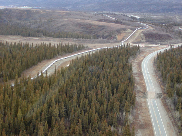
[click to view image] Aerial view of the Trans-Alaska Pipeline and Richardson Highway, looking north. Rupture along the fault resulted in approximately 2.5 meters (8 feet) displacement of the highway, with the north side moving east relative to the south side. (Photo by Patty Craw, DGGS.) |
|
 |
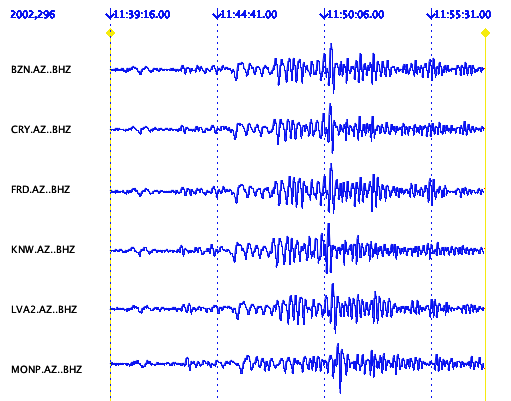
The network in Khorasan province, Iran recorded the Alaska mainshock. The image is from one of the stations ( Char-Cheshmeh). This station gives Ms:7.8 and mb:7.7 for this event. For more information please see http://seismo.um.ac.ir [click to view image] |
 [click to view image] |
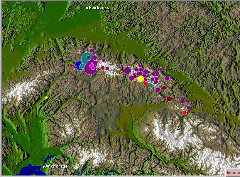
This is a high-altitude view eastward along the main strand of the Denali fault, which is marked here by a prominent linear valley along the southern edge of the Alaska Range. The view shows the approximate location of the epicenter of the magnitude 6.7 earthquake that occurred in the early morning of October 23, 2002. The Denali fault is a major fault that follows an arcuate trace across southern Alaska, following the Alaska Range for much of its length. The eastern part of the fault shows about 400 km of right-lateral strike-slip displacement since early Tertiary time. Offset surficial deposits and seismicity indicate that the fault has remained active to the present, but the October 23 earthquake is the largest seismic event so far recorded on the fault. The Nenana River, in the foreground, marks the eastern boundary of Denali National Park, and the Parks Highway, which connects Anchorage and Fairbanks lies immediately east of the river. The epicenter was approximately 25 miles (40 km) east of the highway. In the distance, the rugged peaks of Mts. Deborah and Hess rise to about 12,000 feet (3650 m) just north of the bend in the Denali fault. (Photo and interpretation by Wesley K. Wallace, Geophysical Institute, University of Alaska Fairbanks) |
|
Events loaded into the Seismic-Eruption software of Alan Jones, SUNY Binghamton visit [click to view image]
|